Backroad Mapbook Southern Alberta 5th Edition
Shipping calculated at checkout
In stock
Pickup currently unavailable
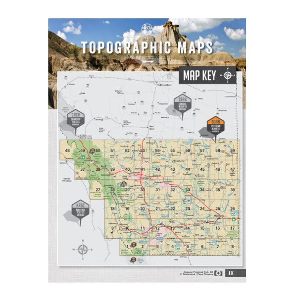
To help you take advantage of Southern Alberta’s many outdoor adventure opportunities, the 5th edition of the Southern Alberta Backroad Mapbook features extensive updates and upgrades from the last publication. Maps now show Crown Forest Management Areas and Public Land Use Zone, along with labelled fish species for individual fishing lakes. Also included are bonus large scale park maps for Banff, Peter Lougheed and Waterton Parks along with an overview park map for Glacier National Park in the states. This Mapbook also contains fish stocking charts for the area’s main stocked species, along with trail charts for several parks and the Trans Canada Trail. Plus, a brand new Backcountry Huts section among our carefully researched Adventure listings.
- 216 page with 59 maps @ 1:225,000 + 8 bonus Park Maps
- Spiral bound book dimension 21.5cm x 28cm (8.5" x 11")
- Map Features: Attractions, ATVing, Camping, Fishing, Hiking, Hunting, Paddling, Skiing, Snowmobiling, Hydrology, logging and industry roads
- Areas Covered: Banff, Blairmore, Bragg Creek, Brooks, Calgary, Canmore, Carstairs, Cochrane, Crowsnest Pass, Drumheller, Fort Macleod, High River, Kananaskis Country, Lake Louise, Lethbridge, Medicine Hat, Okotoks, Olds, Pincher Creek, Sundre, Taber, Three Hills, and more

